
Maxwell’s Zorro Ranch Imagery and Judicial Notice Request
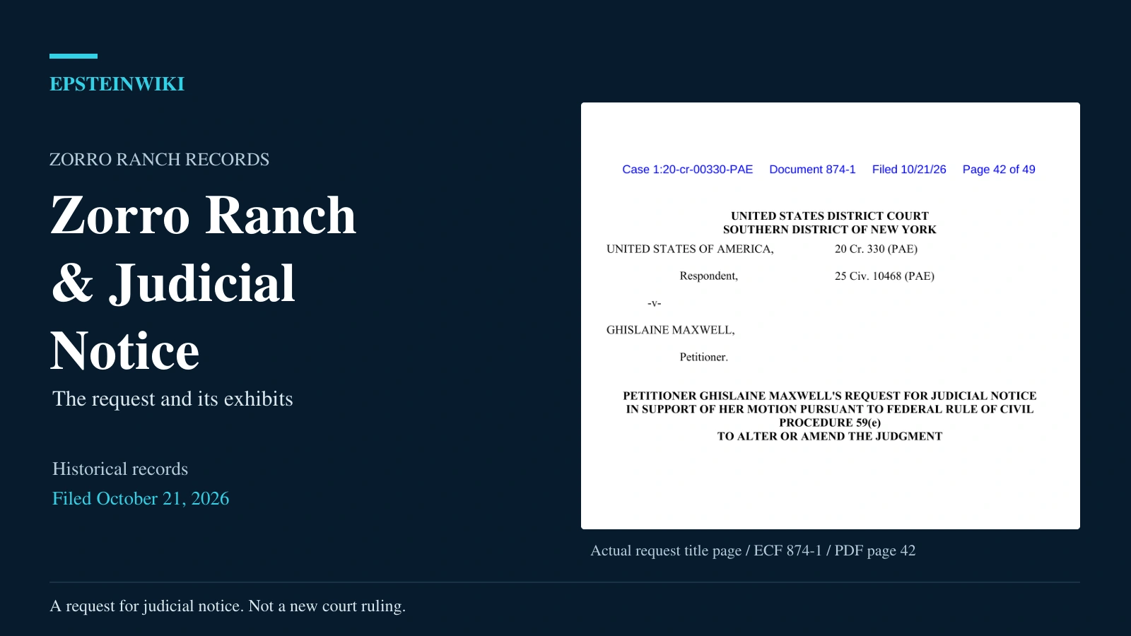
Ghislaine Maxwell’s request for judicial notice asks a federal court to consider historical imagery and public records in connection with her challenge to a judgment. The Zorro Ranch exhibits support her argument about the chronology of a particular residence. They are not a court finding that the residence was built on a particular date or that a witness’s account was disproved.
Snapshot
- The request: Maxwell invokes Federal Rule of Evidence 201 in support of her motion under Federal Rule of Civil Procedure 59(e). The caption identifies 20 Cr. 330 (PAE) and 25 Civ. 10468 (PAE).
- The dates: The request is dated September 22, 2026. The public filing is stamped October 21, 2026.
- The material: Two Google Earth historical views, corresponding attribution captures, a New Mexico commission report excerpt and separate Florida court records.
- The important limitation: The imagery controls display historical dates, while the source panels qualify those dates with the word “older.” The screenshots do not establish exact acquisition dates by themselves.
- The procedural status shown: The last page of the request is an unsigned proposed order, not an issued decision granting judicial notice.
The request’s materials list identifies Exhibits A through F. The 34 page exhibit compilation supplies the documents, but not in alphabetical order. Its repeated internal exhibit labels also require care when citing individual pages.
Why Maxwell submitted the Zorro Ranch material
In the chronology section of her motion, Maxwell distinguishes between the existence of some building on the ranch and the existence of the particular large residence shown in evidence. She contends that a later residence was used to corroborate testimony concerning an earlier visit. That is her argument, not a factual determination made by filing it.
The judicial notice request asks the court to consider the imagery’s displayed dates, location, source attribution, metadata and visible features. Maxwell expressly says she is not asking the court to take judicial notice of witness credibility or the ultimate inference to be drawn from the images.
The submission email is dated September 22, 2026 and describes the attachments as exhibits for that request. That submission date should be distinguished from the October 21, 2026 filing stamp and from the historical dates displayed within the imagery.
What judicial notice would and would not establish
Federal Rule of Evidence 201 concerns adjudicative facts that are not reasonably disputable because they are generally known locally or can be readily and accurately determined from sources whose accuracy cannot reasonably be questioned. It also allows a party to be heard about whether notice is appropriate and what fact is being noticed.
In the request’s explanation of its limits, Maxwell distinguishes the existence and contents of documents from disputed assertions or inferences associated with them. She presents the Google Earth captures as fixed exhibits rather than an invitation for an open ended internet investigation.
The proposed order on PDF page 49 contains language that would grant limited notice if adopted. It is headed “PROPOSED ORDER,” with blank date and signature lines. Its use of “GRANTED” is proposed wording, not evidence that the judge granted the request.
A guide to Exhibits A through F
The request’s exhibit list supplies the letters used below. Page references are PDF pages in ECF 874-3, not the page numbers printed on the documents reproduced inside it.
- Exhibit A, PDF pages 6 and 7: A grayscale Google Earth historical view displaying October 5, 1997, with citation and imagery format notes. The screenshot also bears an earlier stamp identifying ECF 861-3, filed June 24, 2026, page 45 of 79.
- Exhibit B, PDF pages 4 and 5: The corresponding 1997 attribution material. The screenshot on page 4 names the U.S. Geological Survey. Accompanying text says the attribution was independently reconfirmed on September 13, 2026.
- Exhibit C, PDF pages 8 and 9: A color Google Earth historical view displaying July 31, 2005, with citation and imagery format notes. Its earlier stamp identifies ECF 861-3, filed June 24, 2026, page 46 of 79.
- Exhibit D, PDF pages 2 and 3: The corresponding 2005 attribution material. The screenshot on page 3 names NMRGIS. Its text also gives September 13, 2026 as the reconfirmation date. The attachment itself is headed “EXHIBIT B,” although the request assigns the 2005 attribution material to Exhibit D.
- Exhibit E, PDF pages 10 through 14: The cover and four pages from the New Mexico Survivors’ Truth Commission interim report dated August 5, 2026. The body pages run backward: report page 39 is PDF page 11, report page 38 is PDF page 12, report page 37 is PDF page 13, and report page 36 is PDF page 14.
- Exhibit F, PDF pages 15 through 34: A redacted divider, Florida record citation guides and selected court record reproductions. This is a separate branch of the request, not additional construction or aerial evidence.
Both attribution attachments use an internal “EXHIBIT B” heading and refer to a companion “Exhibit [A].” The request’s materials list is therefore the clearest guide to the intended A through F sequence. Those repeated labels do not represent separate corroborating sources.
What the historical views show
The 1997 view is grayscale and the 2005 view is in color. Both show a limited area containing vegetation, tracks or roads, and ground features. The citations identify Zorro Ranch near Stanley in Santa Fe County, New Mexico, and give a common camera center of approximately 35.21732678 degrees north, 105.8797957 degrees west.
The exhibit text also supplies separate search coordinates and camera parameters, including a stated camera range of about 495 meters. Those details document how the filing identifies the view. A coordinate string does not independently establish which building is depicted.
The 1997 caption describes land before major construction and says there is no main residence. The 2005 caption describes a completed main residence compound, guest structures, landscaping and a possible water feature or pool. These descriptions go beyond what the screenshots alone establish.
Those descriptions accompany Maxwell’s exhibits. The reproductions do not include labeled building outlines, a survey, a measured floor area or a verified correspondence between the visible features and the main residence described in the commission report. Identifying a particular house, pool or outbuilding requires more than adopting the captions as established fact.
Why the imagery dates need careful wording
The 1997 attribution capture names the U.S. Geological Survey. The 2005 attribution capture names NMRGIS. Google Earth is the platform displaying the imagery; the panels identify the stated underlying providers.
The historical controls display October 5, 1997 and July 31, 2005. The corresponding attribution date fields include the word “older” before those dates. They should not be rewritten as an assertion that every pixel was photographed on those exact days.
Google’s explanation of imagery dates says that a historical time slider date means the displayed images were captured on or before the selected date. It also explains that imagery can combine photographs from different dates and that acquisition information can be incomplete. A displayed historical date is therefore not automatically an exact acquisition date for the entire view.
These are Google Earth historical views with displayed dates and qualified attribution ranges. Establishing exact acquisition dates would require the underlying dataset information. The screenshots are not original aerial image files and do not supply acquisition records or a provider’s certification of Maxwell’s interpretation.
The September 13, 2026 reconfirmation statements describe a recheck of the displayed attribution, not the date an aircraft captured the imagery. The imagery format notes likewise provide general context, not independent dating of a particular photograph. The 2005 notes expressly distinguish NAIP, discussed as background, from NMRGIS, the source named in the panel.
What the New Mexico report actually contributes
The filed report cover identifies the New Mexico House of Representatives, the New Mexico Survivors’ Truth Commission, special counsel Fadduol, Cluff, Hardy & Conaway P.C., and an August 5, 2026 date. The commission’s own archive lists an August 2026 interim report. The discussion here concerns the excerpt attached to ECF 874-3, rather than substituting a later online version.
On report page 38, reproduced at PDF page 12, the commission states that the later 28,636 square foot main residence did not exist when Epstein bought the ranch and describes an earlier temporary structure. It attributes the property improvement information to the Santa Fe County Assessor and lists a three story main residence constructed in 1999.
Footnote 27 cites an assessor’s sketch and property description dated May 1, 2026. That document is not reproduced in the five-page excerpt, which supplies only the commission’s account of the property information.
The same property improvement passage lists a guest house dated 1962 and several guest houses dated 1994, alongside improvements dated 1998 and 1999. That context prevents a broader inference that the ranch lacked buildings before 1999 or that a visit before then was impossible. The report distinguishes the later main residence from other structures on the property.
Report page 39, reproduced at PDF page 11, includes a photograph captioned as the main residence and outbuildings, sourced to the Maxwell case. It describes continuing maintenance and improvements from 1994 to 2019. It also states that a complete maintenance accounting has not been conducted and that relevant financial records are scattered and incomplete.
The photograph’s case citation is not an acquisition date for the photograph. Nor does the photograph independently establish that the main residence pictured is the structure identified in the Google Earth captions. The remaining report pages concern acquisition, acreage, leases and a parcel map. They are not construction permits, certificates of occupancy or a complete building history.
The unexplained difference in building size
The 2005 screenshot caption estimates a main house of approximately 10,000 square feet. The report excerpt describes a 28,636 square foot main residence.
The attachment does not reconcile those figures or establish that the structure identified in the caption is the residence described by the assessor. The figures cannot be treated as interchangeable or as measurements taken from the screenshot.
Why Florida records appear in the same attachment
The request’s description of Exhibit F calls it a roadmap to official Florida court records and does not represent that certified paper copies are attached. The compilation nevertheless contains reproductions of selected records alongside citation guides. Those document types should not be treated as interchangeable.
- PDF page 15 is a largely redacted divider.
- PDF pages 16 through 18 contain a master citation guide describing the Florida docket, a probation order, a waiver of rights and an FBI interview record citation. The guide is not the complete docket or the underlying interview report.
- PDF pages 19 through 24 and PDF pages 25 through 30 contain substantially repeated supporting citation guides. They carry a September 12, 2026 preparation date and describe themselves as research aids not reviewed or filed by an attorney. They refer to a docket captured on June 9, 2026 and distinguish certified, uncertified and not yet obtained material. Repetition is not independent corroboration.
- PDF pages 31 and 32 reproduce a redacted waiver of rights bearing a December 15, 2017 filing stamp. It is marked as not a certified copy.
- PDF pages 33 and 34 reproduce an electronic certification cover dated June 8, 2026 and a redacted order of revocation of probation. The cover’s presence is different from independently verifying the electronic record.
The supporting guides argue that records refer to a written plea agreement absent from the docket they reviewed. The reproduced order directs the reader to an attached plea agreement, and the waiver refers to promises in a written agreement.
Those references do not disclose the agreement’s full terms or independently establish what a complete search of the official record would produce. Without more, they do not prove a cooperation bargain, a motive to testify or misconduct. Names and case identifiers redacted in the filing remain redacted here. Understanding the request does not require reconstructing those identities.
What remains unresolved
The exhibits document Maxwell’s request and the sources she selected. Separate questions remain about exact imagery acquisition dates, identification of the relevant building, the underlying assessor record and the relationship between property development and particular testimony.
The request itself disclaims judicial notice of credibility and ultimate inferences. Establishing when the later residence was built would not, by itself, establish when a witness visited the ranch, which building was involved or whether an alleged event occurred.
The unsigned proposed order does not show that the court granted the request. This article describes the request and its exhibits as publicly filed on October 21, 2026.
Related coverage
- Rule 59(e) filing overview
- NPA negotiations and victim notification
- Operation Stolen Globe and trial discovery
- Florida file review and FOIA records
- Complete exhibit source guide
Sources
- ECF 874-3, the 34 page exhibit compilation, including historical imagery, attribution panels, report excerpts and Florida record material.
- ECF 874-1, the accompanying motion and judicial notice request. The request begins at PDF page 42, its exhibit list is on page 46, and the proposed order is on page 49.
- Federal Rules of Evidence, Rule 201, printed page 3 and PDF page 18 of the official rules publication.
- Google Earth Help, How images are collected, explaining historical imagery dates, mosaics and acquisition information.
- New Mexico Survivors’ Truth Commission meeting archive, listing the August 2026 interim report. Substantive report citations above refer to the excerpt filed in ECF 874-3.